Bring Your Land Data to Life
With regional offices across the country, CLS’s fully staffed GIS department is ready to support your infrastructure projects, no matter how big or small.
With regional offices across the country, CLS’s fully staffed GIS department is ready to support your infrastructure projects, no matter how big or small.
The CLS GIS Department has extensive experience planning and consulting internally and for our clients. Diverse backgrounds within the team have aided in advancing our GIS knowledge and capabilities. We have conducted extensive Needs Assessments and successfully developed/implemented GIS Strategic Plans. We are experienced in the analysis of data and workflows, and in identifying and implementing of solutions.
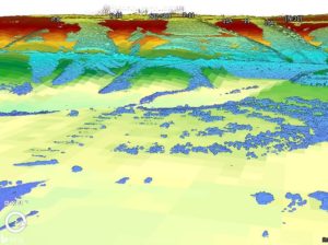
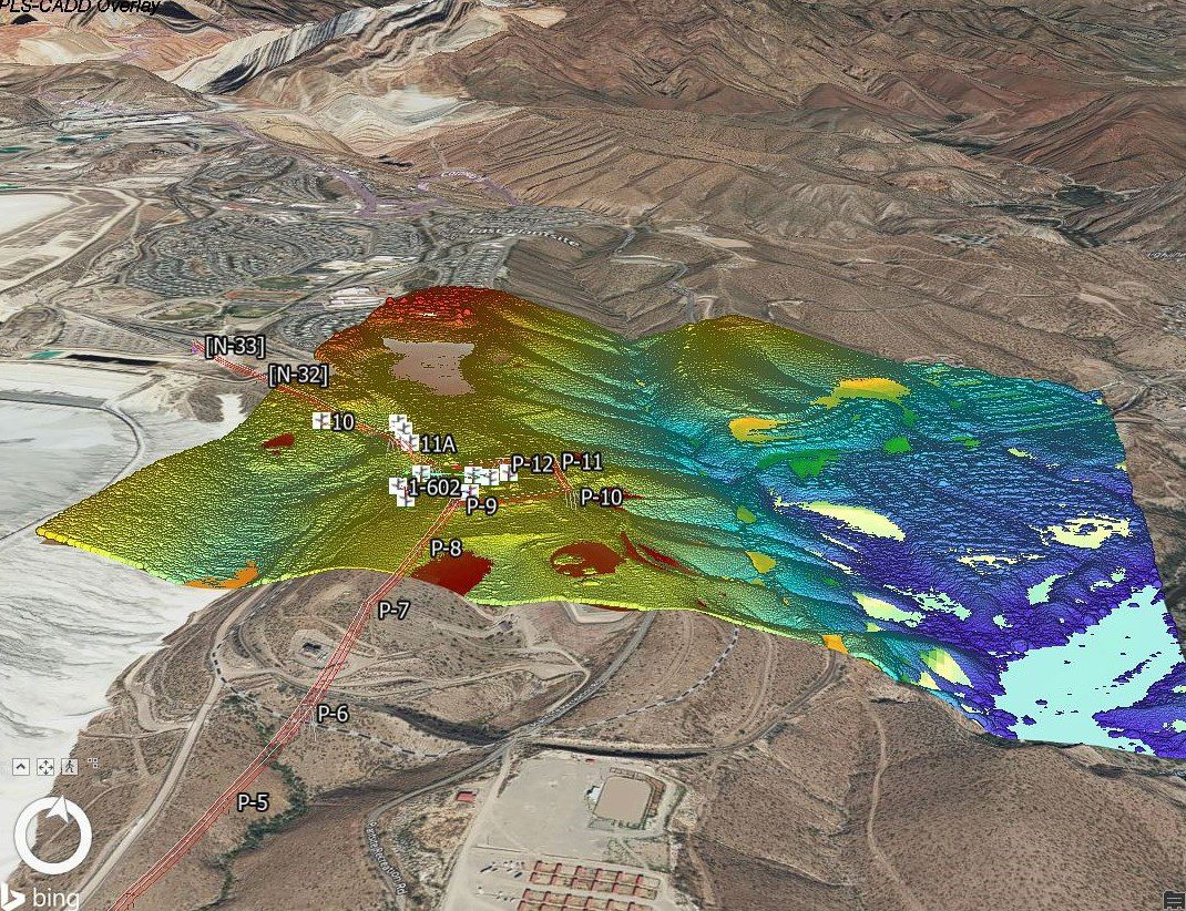
Our GIS and Digital Mapping services combine powerful web-based database tools with in-depth data visualization. The services can integrate location and database information into one comprehensive, layered digital map enabling visualization of patterns, relationships, and trends. CLS’s GIS and Digital Mapping system allows for the assembly, storage, manipulation, and display of geographically referenced information and provides real-time access to supporting database files. CLS’s GIS and Digital Mapping solutions tie critical data to a powerful visual representation of an entire project. CLS’s secure, online interactive web application has the ability to:
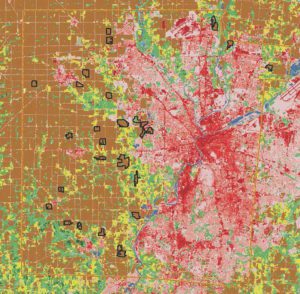
Our team is constantly updating GIS geometries and their attributes. We are skilled in creation, import, refinement, conversion, and modification of complex datasets. We are skilled in parcel fabrics, pipeline management, electric transmission, solar farms, wind farms, transportation/roadways, railways, and State/County/City datasets. In addition to working with GIS raster and vector data, CLS also provides access to these data through map, geodata, and imagery services for use in applications, as well as for internal GIS workflows and analysis. We often create GIS Data where none previously existed, using legal descriptions, plats, maps, or survey data. Through scripting and modeling, CLS has developed automated data exports and data integrity tools to ensure timely, accurate data delivery to our clients.
"*" indicates required fields